Severe Weather Alert: Critical Thunderstorm Warnings Issued Across Multiple Australian States
Anúncios
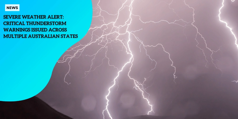
Current Weather Alert Status
Millions of Australians are currently under severe weather alerts as thunderstorms grip multiple regions across the country.
The Bureau of Meteorology has issued warnings covering New South Wales, Victoria, Queensland, Northern Territory, and Western Australia.
Anúncios
These severe thunderstorms bring the threat of damaging winds, heavy rainfall, large hailstones, and potential flash flooding.
Areas Under Threat
Regions specifically facing immediate threats include major metropolitan areas such as Sydney, Wollongong, and Newcastle.
Anúncios
As of the latest updates, thunderstorms have been moving east to northeast, impacting areas like Wollongong, Camden, Picton, and Bucketty.
This movement is expected to extend to Campbelltown, Warragamba, Helensburgh, Parramatta, Sutherland, Sydney Olympic Park, Richmond, Liverpool, and Penrith within hours.
State-wide Alerts
Other parts of New South Wales under alert include the Hunter, Illawarra, and Central Tablelands forecast districts.
In Victoria, the affected areas are the Central, East Gippsland, North Central, North East, and West and South Gippsland forecast districts.
The potential for damaging winds is high, and locations like Seymour, Traralgon, Sale, Maffra, Bairnsdale, and Mt Baw Baw are on alert.
Similarly, Western Australia’s Pilbara and Gascoyne districts, parts of Queensland, and areas within the Northern Territory are gearing up for severe weather impacts.
Areas in the North East Pastoral district of South Australia received warnings earlier and continue to monitor the situation closely.
Precautionary Measures
The State Emergency Service (SES) emphasizes the need for residents to follow safety precautions meticulously. Key instructions include:
| Safety Measure | Description |
|---|---|
| ⛈️Moving cars under cover and away from trees | ⛈️This helps prevent damage to vehicles from falling branches or debris during storms. |
| ⛈️Securing loose items around houses, balconies, and yards | ⛈️Prevents items from being blown away or causing damage during high winds. |
| ⛈️Keeping at least 8 meters away from fallen power lines | ⛈️Avoids electrocution risk from power lines that may be live after a storm. |
| ⛈️Staying indoors, avoiding windows, and unplugging electrical devices | ⛈️Minimizes the risk of injury from flying debris or power surges during storms. |
| ⛈️Ensuring children and pets are kept indoors | ⛈️Protects vulnerable family members from the dangers of severe weather. |
| ⛈️Avoiding creeks and storm drains | ⛈️Prevents the risk of drowning or being swept away by flash floods. |
| ⛈️Not walking, riding bikes, or driving through flood waters | ⛈️Protects against the risks of being caught in fast-moving water. |
| ⛈️Seeking the highest available place for refuge if trapped by flash flooding | ⛈️Ensures safety by reaching higher ground to avoid floodwaters. |
These proactive steps can significantly reduce storm-related hazards and ensure the safety of residents in affected regions.
As these severe thunderstorms continue, it’s crucial for everyone in the impact areas to stay updated with real-time alerts from reputable sources.
By remaining vigilant and prepared, communities can better navigate the severe weather conditions.
Affected Areas and Timeline
Immediate Threats to Major Metropolitan Areas
Residents in major cities like Sydney, Wollongong, and Newcastle are facing immediate threats due to severe thunderstorms.
The Bureau of Meteorology has advised that these metropolitan areas could experience damaging winds, heavy rainfall, and large hailstones.
As of specific times, storms were expected to affect various suburbs, including Campbelltown, Warragamba, and Helensburgh by 7:25 pm, and areas like Richmond, Penrith, and Sydney Olympic Park by 7:55 pm.
 Sydney will be affected
Tracking the Storms
The storm systems are steadily moving from west to east and transitioning to the northeast.
By Monday evening, thunderstorms were reported near Wollongong, Camden, and Picton, later moving toward the Greater Sydney region.
This eastward progression of storms is expected to impact different districts sequentially, allowing residents just a few hours to take the necessary precautions.
Simultaneous Severe Weather Conditions
Areas across New South Wales, Victoria, Queensland, Northern Territory, and Western Australia are not just dealing with storms one after another.
Multiple districts are experiencing these severe weather conditions at the same time.
In New South Wales, storm warnings were issued for Maitland, Gosford, and Wyong.
Similarly, in Victoria, the Central, East Gippsland, and North East regions have been warned about possible damaging winds and heavy rain.
Other regions under alert in Queensland, Northern Territory, and Western Australia include both northern and isolated western areas.
For instance, warnings were issued in the Pilbara and Gascoyne districts of Western Australia and the North East Pastoral district in South Australia.
This wide geographic spread means that practically every part of the country must remain vigilant.
Given the concurrent threats, it is vital for everyone in these affected areas to stay informed and prepared.
Keeping up with real-time updates and following the safety instructions issued by local authorities will help communities to manage the unfolding situation effectively.
As severe weather conditions are anticipated, taking precautionary steps is crucial for everyone’s safety.
Safety Measures and Emergency Response
As severe weather continues to batter multiple states across Australia, the State Emergency Service (SES) has issued a comprehensive set of safety guidelines for residents.
Here are the key measures to ensure your safety during these extreme weather conditions.
Securing Property
With the predicted threats of damaging winds, heavy rainfall, and large hailstones, protecting your property is crucial. The SES advises the following:
- ⛈️ Move Cars Under Cover: Park vehicles in garages or under cover to prevent hail damage.
- ⛈️ Secure Loose Items: Anchor outdoor furniture, umbrellas, and other objects that could become airborne and cause damage or injury.
- ⛈️Trim Overhanging Branches: Remove dead or overhanging branches near your home to reduce the risk of falling debris.
- ⛈️ Clear Gutters and Downpipes: Ensure water flows freely during heavy rain to prevent flooding around your property.
Flood Safety Precautions
Flash flooding poses a significant threat during severe thunderstorms.
The SES provides specific instructions to mitigate risks in flood-prone areas:
- ⛈️ Avoid Driving Through Flood Waters: It only takes a small amount of water to float and potentially sweep away a vehicle. Do not attempt to drive through flooded roads or creeks.
- ⛈️ Stay Clear of Watercourses: Keep away from rivers, streams, and storm drains that may overflow.
- ⛈️ Unplug Electrical Devices: To prevent electrical hazards, unplug computers and other gadgets during high-risk weather.
- ⛈️ Stay Inside: Remain indoors and keep children and pets inside during severe weather events.
Emergency Contact Protocols
Knowing who to contact and how to respond during an emergency is vital.
Here are the emergency protocols outlined by the SES:
- ⛈️ Seek Refuge in High Places: If you are trapped by flash flooding, move to the highest available location.
- ⛈️ Call for Help: Dial Triple Zero (000) for emergency assistance if you require rescue services.
- ⛈️ Stay Informed: Monitor local weather updates and heed the instructions of emergency services.
These precautions are essential to minimizing risks and ensuring the safety of residents across the affected regions.
Given the simultaneous experience of thunderstorms and a severe heatwave in states like NSW, Queensland, and Western Australia, it’s critical to remain vigilant and prepared for both weather extremes.
Next, we’ll delve into the ongoing heatwave warnings, exploring the additional precautions necessary to manage the simultaneous risks of storms and extreme heat.
Concurrent Heatwave Warnings
Australians are not only bracing for severe thunderstorms but also contending with sweltering heat.
The Bureau of Meteorology has issued severe heatwave warnings for multiple states including New South Wales (NSW), Queensland, and Western Australia.
This double punch of extreme weather is challenging residents to stay vigilant and prepared.
Intense Heat and Affected Areas
Temperatures across various regions are expected to soar, with some areas reaching up to a scorching 42°C.
Penrith and Richmond in NSW are forecasted to experience these extreme highs on Tuesday, while Parramatta, Campbelltown, and Liverpool will see temperatures hitting around 41°C.
Sydney itself is set to reach a high of 40°C, with chances of rain and thunderstorms providing a slight respite from the relentless heat.
In Queensland, areas such as the North West and Channel Country Districts are under severe heatwave warnings from Monday through to Thursday.
Residents there should brace for continued high temperatures.
Similarly, Western Australia will face extreme heat conditions in the Pilbara, Gascoyne, North Interior, South Interior, Central West, Lower West, and Central Wheat Belt Districts.
Each of these regions requires careful management to mitigate the risk of heat-related illnesses and complications arising from the concurrent severe thunderstorms.
Managing Heat and Storm Risks
Residents need to adopt a set of precautions to cope with the dual threats of extreme heat and impending storms.
Some vital measures include:
- ⛈️ Seek Cool Places: Stay indoors in well-ventilated or air-conditioned spaces whenever possible. Use fans or air conditioners to maintain a comfortable temperature.
- ⛈️ Keep Homes Cool: Close windows and curtains early in the day to block out the heat. Create a shaded environment to reduce indoor temperatures.
- ⛈️ Stay Hydrated: Drink plenty of water frequently, even if you don’t feel thirsty. Avoid alcohol, caffeine, and sugary drinks as they can contribute to dehydration.
- ⛈️ Avoid Overexposure: Limit your time outdoors, particularly during the hottest part of the day (usually mid to late afternoon). If you must go outside, wear lightweight, loose-fitting clothing and a wide-brimmed hat.
Additionally, with storms posing a significant threat, complementary precautions are vital:
- ⛈️ Secure Property: Ensure that loose items around your home, such as outdoor furniture and toys, are secured or brought inside to prevent them from becoming projectiles during high winds.
- ⛈️ Stay Updated: Keep an eye on weather updates from reliable sources such as the Bureau of Meteorology and local news stations. Pay attention to alerts and warnings.
- ⛈️Emergency Preparedness: Have an emergency kit ready, including essentials like water, non-perishable food, medications, and important documents. Make sure you know the emergency contact protocols and rescue procedures.
Being prepared for both the severe heat and the impending thunderstorms is crucial to ensuring safety during these extreme weather conditions.
Stay informed, take the necessary precautions, and prioritize your and your family’s safety at all times.
Regional Weather Forecasts
Temperatures Across Major Cities
As Australia faces a mix of severe weather conditions, the Bureau of Meteorology has provided detailed temperature forecasts for key metropolitan areas.
Sydney is preparing for a high of 40°C, with probable thunderstorms adding to the potential disruption.
Melbourne’s forecast is significantly cooler, anticipating a maximum of 22°C with chances of light showers.
Perth, on the other hand, is bracing for intense heat, expecting temperatures to reach 37°C.
Elsewhere, Adelaide can expect a milder day at 27°C.
Hobart is set to be relatively cool at 20°C, though it may see slight showers.
Canberra’s weather sees wide fluctuations, with highs of 37°C accompanied by showers and potential thunderstorms.
Varying State Conditions
The severity of weather conditions varies widely across regions.
In New South Wales, areas including the North West Slopes and Plains, as well as the Northern Tablelands, are experiencing both severe thunderstorms and intense heatwaves, creating a dangerous combination.
Queensland’s weather threats are particularly pronounced in the North West and Channel Country Districts, with heatwaves pushing temperatures up to 42°C.
Western Australia is seeing heatwave warnings across districts like Pilbara and Gascoyne, reaching temperatures similar to Queensland’s highs.
Expected Duration and Intensity
These severe weather patterns are expected to persist over the next several days.
Thunderstorms in New South Wales and Victoria are moving east to northeast and should continue to impact these regions through the evening.
The heatwave in Sydney and surrounding areas is likely to last until mid-week, with temperatures beginning to moderate after Thursday.
Similarly, Queensland and Western Australia’s heatwave warnings, issued from Monday, are expected to remain in effect well into the week.
As Australians brace for these dual threats of thunderstorms and extreme heat, staying informed and prepared is of utmost importance.